One of our main interests at mappable is to find creative ways to use (geo-)data for mapping urban dynamics. In our newest project we will explore how phone directories can serve as a data source for various analytical tasks, starting with urban migration patterns.
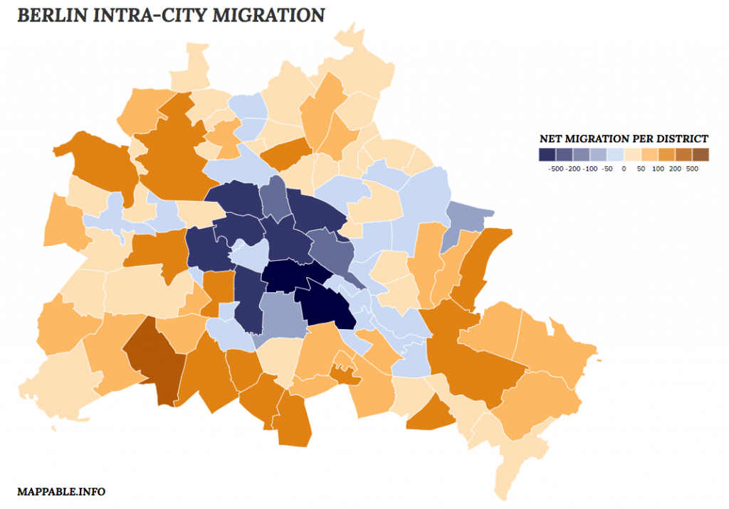
For this purpose we bought German CD-ROM phone directories for the years 2004 – 2012 and exported all datasets for Berlin. We subsequently identified approximately 50.000 individual intra-city relocations and started to visualize and analyze the derived migration data. The first result of our work is an interactive, explorative visualization that let’s you explore Berlin’s intra-city migration patterns with high spatial granularity. You can take a closer look at it and explore the dataset on your own by clicking on the image bellow.
The migration patterns generated with our approach resemble those of the city’s official migration statistics. Thanks to the fact that our raw data are addresses, we are even able to analyze intra-city migration on a more detailed level than with the officially released data, which is aggregated to the county (‘Bezirk’)-level.
To sum things up: we are quite enthusiastic about the potential of phone directories as a data source and there are definitely more research questions that can be answered with these data sets besides only migration patterns (e.g. monitoring gentrification processes, identifying ethnicity patterns).
We will continue to publish short updates about this project here on our blog. If you want to take a more in depth look, see our project page, where you can find some words on how we processed the data, created the visualization and how we interpret the migration patterns we’ve found.


